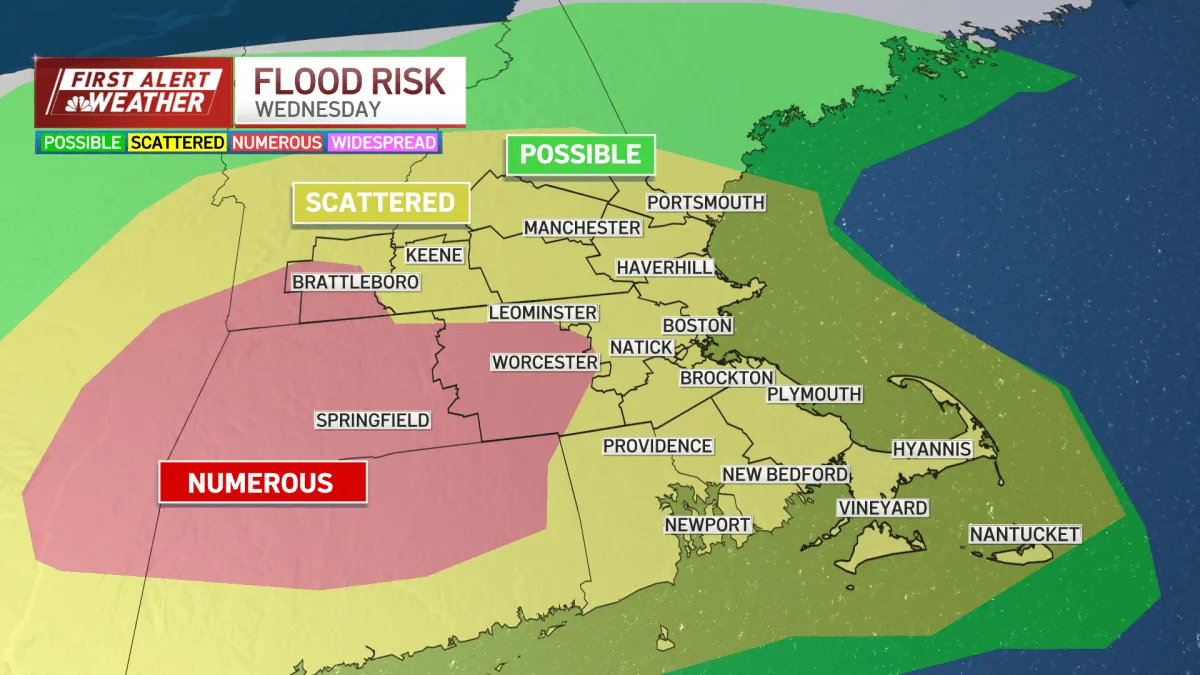
BOSTON, MA — A slow-moving storm brought periods of rain across southern New England on Wednesday, with the heaviest downpours creating a risk for flash flooding in several places. Forecasters said the rain was expected to continue through Thursday evening, although the intensity should ease as the storm gradually weakens. The greatest concern centered on western and central Massachusetts, northern Connecticut and northern Rhode Island, where heavier bands of rain could dump water quickly. During the evening commute, the flood risk also shifted toward the Providence and Boston areas.
Flooding Risk Spreads
Rain fell steadily at times through the afternoon and evening, and some neighborhoods saw bursts of heavier rain. Officials warned that travelers could run into flooded roadways, water-covered underpasses and reduced visibility when the rain came down hardest. Small streams and low-lying areas were also expected to rise quickly if the heaviest bands stalled overhead. Flash flood warnings were issued Wednesday afternoon for parts of Massachusetts and Connecticut, and a flood watch remained posted for southern New Hampshire until 8 a.m. Thursday. The weather setup left several communities watching the same storm in different ways at the same time.
Rain Totals Keep Rising
Most areas were expected to pick up another 2 to 4 inches of rain before the system moved on, and isolated locations hit by the most persistent downpours could see more than 4 inches. That amount was enough to keep the flood threat in place even where the rain looked brief between heavier bands. The forecast called for rain to turn lighter on Thursday, but cloudy skies and scattered showers were likely to linger into the day. The storm’s slow pace meant water problems could develop gradually in some spots and quickly in others, depending on where the heaviest rain fell.
Worcester Sets Record
One of the day’s standout totals came from Worcester, where rain on July 29 reached 2.64 inches, setting a record for the date. That amount topped the previous July 29 record of 1.82 inches, which had stood since 1980. The new mark underscored how productive the storm was in parts of Massachusetts, even as rain totals varied from place to place. Forecasters said the heaviest rain bands were not expected to stay locked in one area, which meant the risk for flooding could change as the storm drifted east and southeast through the region.
Weekend Brings Relief
After the storm exits, much of the region should get a stretch of drier weather heading into the weekend. That break may offer some relief for communities dealing with soaked roads, saturated yards and high stream levels left behind by the rain. The dry spell is not expected to last all that long, though, because the chance for showers and thunderstorms is forecast to increase again early next week. For now, the main concern remains the remaining rounds of rain through Thursday evening and the possibility that additional downpours could push already wet spots into flooding.